Back ليدز رين ARZ Leidse Rijn CEB Rhin de Leyde French Leienske Ryn Frisian Leidse Rijn Italian ლეიდსე-რაინი Georgian Leidse Rijn Dutch Leidse Rijn NN Leidse Rijn NB ლეიდსე-რაინი XMF
| Leidse Rijn Leiden's Rhine | |
|---|---|
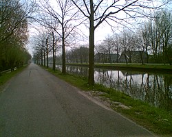
 Leidse Rijn between Harmelen and De Meern | |
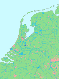
 Location of Leidse Rijn in dark blue. | |
| Location | |
| Country | Netherlands |
| Province | Utrecht |
| Physical characteristics | |
| Source | Kromme Rijn |
| • location | Utrecht, Utrecht |
| • coordinates | 52°05′33″N 5°06′38″E / 52.09250°N 5.11056°E |
| Mouth | Oude Rijn |
• location | Harmelen, South Holland |
• coordinates | 52°05′31.5″N 4°57′48.5″E / 52.092083°N 4.963472°E |
| Length | 13 km (8.1 mi) |
 | |
The Leidse Rijn (Dutch for "Leiden's Rhine") is a canal in the province of Utrecht, Netherlands.[1]
It was dug since the Middle Ages when the meandering old Rhine course silted up.
The Leidse Rijn has a length of 13 km. Towns along the Leidse Rijn are De Meern and Harmelen. While still in Utrecht city the Leidse Rijn crosses the Merwede Canal and the Amsterdam-Rhine Canal.
It is the continuation of the Kromme Rijn (Crooked Rhine) through the moat system of Utrecht. The canal ends in Harmelen. There it connects to the Oude Rijn, which eventually flows into the North Sea at Katwijk aan Zee.[2]
The canal gives its name to the Utrecht neighborhood of Leidsche Rijn.
- ^ Bik, M. H. (2006-03-02). The Rhine. Springer Science & Business Media. p. 23. ISBN 978-3-540-29393-4.
- ^ Beller, Manfred; Leerssen, J. Th (Joep) (2017-09-04). The Rhine: National Tensions, Romantic Visions. BRILL. p. 14. ISBN 978-90-04-34406-8.